By improving knowledge of wetlands at the national level, the mapping of these ecosystems supports the steering of public policies for the preservation, management and restoration of wetlands.
The national wetlands mapping project is about modeling wetlands in metropolitan France. It aims to pre-locate wetlands and characterize them using a predictive approach. For this purpose, models based on high spatial resolution remote sensing data are calibrated from field surveys (vegetation, soil) available in different databases.
Supported by the Water and Biodiversity Directorate of the Ministry of Ecological Transition and Territorial Cohesion, the project is accompanied by a project team composed of experts and researchers from the University of Rennes 2, the PatriNat unit (OFB - MNHN - CNRS - IRD), the Agro Institute, the National Research Institute for Agriculture, Food and the Environment (Inrae) and the Tour du Valat. The water agencies are also supporting the mapping project by putting them in contact with the collectivities.
This need for increased knowledge was highlighted in the report "Terres d'eau, terres d'avenir" (Land of water, land of the future) by the parliamentary mission for the preservation, restoration and enhancement of wetlands.
The project includes two phases:
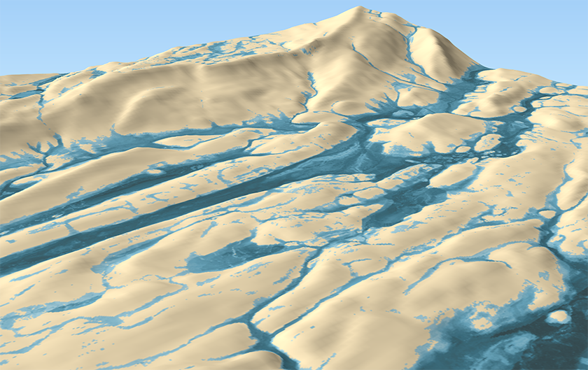
Cartographic modeling of wetlands © G. Gayet / PatriNat
Ten test catchment basins located in various ecological contexts were selected with the participation of water agencies. They represent approximately 10% of the surface area of metropolitan France.
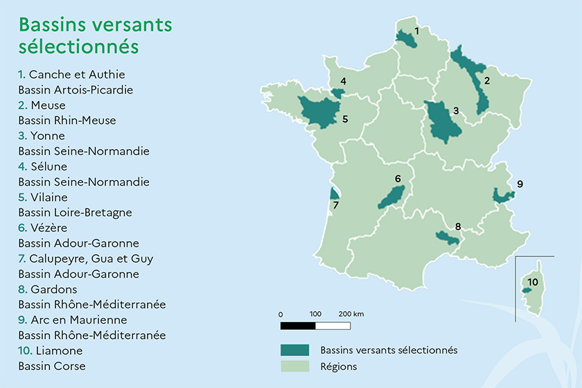
The 10 selected catchment basins
© MTECT - DGALN, mars 2021. Conception Citizen Press
Taking into account the expertise, knowledge and practices of territorial actors is a central element of the project. Local referents are associated to test the cartographic results and their applications. They are designated by the structures involved in the management of the catchment basins concerned by the project. For this, specific workshops are organized in the territories from June to September 2022.
A seminar will be organized in 2023 at the Muséum National d'Histoire Naturelle to present the main results and to evaluate this first phase.
Information on the National Wetland Mapping 2023 Conference
The perspectives of valorization of these cartographic models are various:
These maps are compatible with the Sandre "wetlands" dictionaries and scenarios. They are available - in free access - on the platform of the wetlands data partnership network.
These technical tools of knowledge on wetlands and their functioning do not replace the knowledge reports of wetland inventories and have no regulatory value.
 French Version