Officially launched in 2007 by the ministry in charge of environment, the geological heritage is part of the law of the 27th of February 2002. It specifies (Environment code, Art. L. 411-5) that "the state (…) assures the conception, the animation and the evaluation of the natural heritage inventory which includes the ecological, faunal, floral, geological, mineral and paleontological resources".
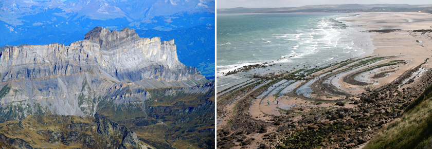
Désert du Platé, Haute-Savoie © C. Giusti & Anticlinal du cap Gris-Nez, Pas-de-Calais © P. De Wever
The geological heritage inventory of the whole French territory aims at:
The inventory has first of all an informative vocation. However on the basis of the information collected, it will also help define and put in place a single or several adapted policies in favour of the management and the valorisation of the heritage. Consequently, this inventory is a good opportunity to evaluate as much as possible every site by taking into account particularly its conservation status and the probable needs and means to implement in order to preserve it.
At the end this inventory would build up a national reference which will be integrated in the Natural Heritage Inventory Information System (Système d'information de l'inventaire du patrimoine naturel; SINP), set up by the ministry in charge of environment. This data will be available to citizens who will thus benefit of this information about the geological resources of their region as well as their cartographic location. Land managers will be able to use this inventory as an information tool and as this help to decide. Henceforth some threatened and vulnerable and/or remarquable biotopes and geotopes might be preserved by being listed in this inventory. In a professional framework French or foreign scientists will be granted access to those data. They will eventually be part of major international programmes of inventories related to the UNESCO.
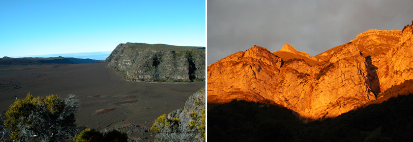
Piton de la Fournaise, La Réunion © M-M. Blanc-Valleron & Falaise calcaire, Massif des Bauges, Savoie © P. De Wever
The goal being to achieve to establish a coherent inventory throughout the whole French territory, the elaboration of common methodology had been necessary in order to insure an harmonized work. Concerning the geological heritage, the series of steps has been reviewed, experimented and confirmed by the Permanent Conference of the Geological Heritage (Conférence Permanente du Patrimoine Géologique; CPPG), a think-tank constituted by the Ministry of Ecology and of Sustainable Development (Ministère de l'écologie, du Développement durable; MEDD) which includes: the MNHN, the BRGM, the SGF, the museums of France (Musées de France), the RNF, the FFAMP and two experts.
This project has managed the work to be published in 2006, ("Vade-mecum for the inventory of the national geological heritage"). The methodology of the programme is presented in “Géopatrimoine en France”, published in 2014. The text is downloadable on the page “Documentation”.
The data are gathered at the regional level; it is directly operated onto the Internet by the means of an online capture software named iGEOTOPE. The access of the site is granted to the people registered onto the programme. A diversity of useful documents to the making of this inventory is available for download: the vade-mecum, data sheets as well as the methodological guide of the inventory. After approval (regionally) by the Regional Scientific council of the Natural Heritage (Conseil Scientifique Régional du Patrimoine Naturel; CSRPN); the data, for approval on a national scale, is transmitted to the MNHN, which chose to rely on a national Commission.
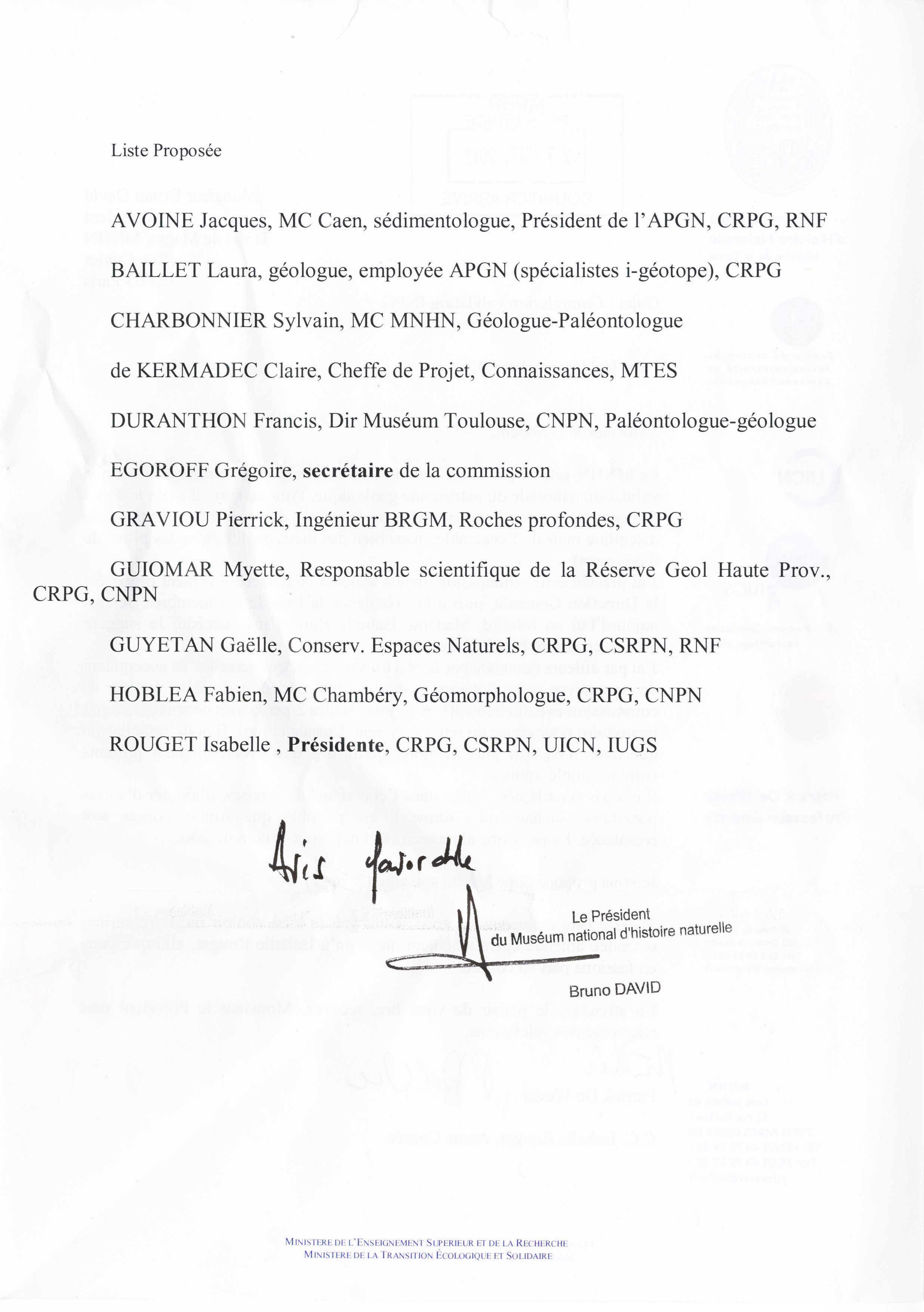
Composition of the National Validation Commission for Sites
The DREAL (Regional Directorate for Environment Development and Housing) are the project managers for the inventory, they rely on a scientific secretary and on a CSPRN. A Regional Commission of the Geological Heritage "CPPG" (geological emanation of the CSRPN), is headed by a geologist acting as scientific coordinator, may be created to organize and control this inventory of the geological heritage. The establishment of those commissions forms a true dynamic which ensure the successful completion of inventories. The data are transmitted via the whole geological network: professionals, amateurs, associations and learned societies. The ministry in charge of the environment is a sponsor of this project, he coordinates the DREAL and the MNHN and brings a financial aid to the functioning of this programme.
For more information
 French Version